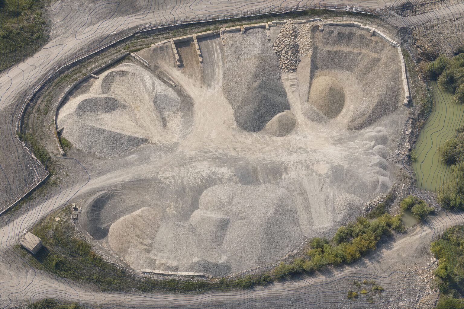
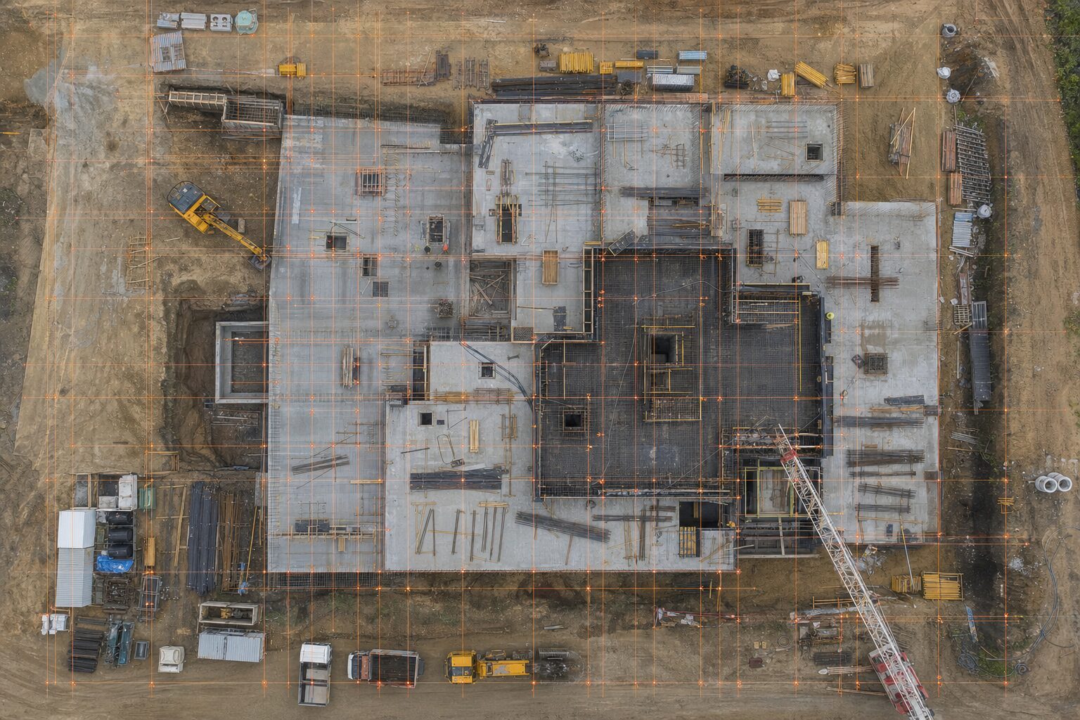
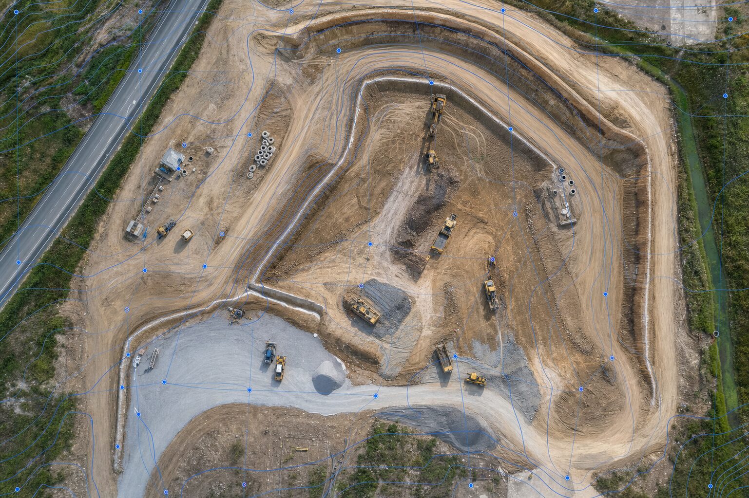
Orthomosaic & Topographic Mapping
Georeferenced orthomosaics, digital surface and terrain models, and 1–2 ft contours suitable for civil design.
- Orthomosaic
- DSM / DTM
- Contours
- CAD export
RTK photogrammetry, LiDAR, and construction monitoring for the engineering, construction, and infrastructure teams that build the Kansas City metro. CAD and GIS-ready deliverables in 24 to 48 hours.
Capture acres in hours, not days. Standard scopes delivered in 24–48 hours.
RTK GNSS and LiDAR workflows produce engineering deliverables, not just photos.
Civil 3D, ArcGIS Pro, point cloud, and PDF exhibit packages your team can drop in.
Available for security-sensitive, public-sector, and federally influenced scopes requiring stronger supply-chain alignment.
From small-site orthomosaics to LiDAR corridor mapping, every deliverable is processed, QA-checked, and exported in the formats your engineers and surveyors actually use.
Georeferenced orthomosaics, digital surface and terrain models, and 1–2 ft contours suitable for civil design.
DJI Zenmuse L2 LiDAR for vegetation penetration, classified point clouds, and bare-earth terrain models for higher-precision scopes.
Repeatable site capture with comparison-ready outputs. Cut/fill analysis and digital documentation for every milestone.
Single-site or recurring stockpile measurements with calculated volumes and a delivered summary report for inventory and billing.
Roof, tower, solar, and corridor inspections. Safer than ladder-and-rope crews with reportable, archivable imagery.
Digital twins and as-built support, plus processing-only services for clients capturing their own imagery or LiDAR.
Most local drone shops don't carry LiDAR. We do. RTK-enabled DJI Matrice 350 with the Zenmuse L2 sensor delivers classified point clouds, bare-earth terrain models, and vegetation-penetrating workflows for corridors, infrastructure, and complex sites.
A predictable workflow with QA at every step. Most clients move from quote to final deliverable inside a week.
Discovery call to define site, deliverables, accuracy targets, and turnaround. Quote issued same or next day.
Mission planning, airspace and LAANC review, ground control or RTK setup. Site access coordinated with your team.
Part 107 flight execution. RTK or LiDAR payload depending on scope. Field documentation captured for QA chain-of-custody.
Photogrammetry or LiDAR processing in Pix4D, DJI Terra, or DroneDeploy. QA against project specifications.
CAD, GIS, point cloud, and PDF deliverables via secure portal. 24–48 hour turnaround on standard scopes.
From civil engineering and survey firms to GCs, developers, and municipal departments — we deliver the geospatial inputs your design and field workflows need.
Tell us about your project — site location, scope, deliverables, and timeline. We'll get a quote back to you within one business day.